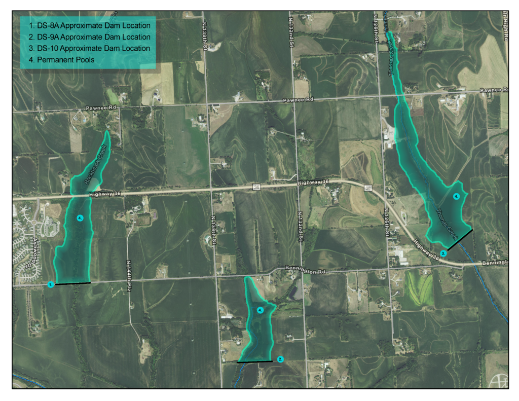
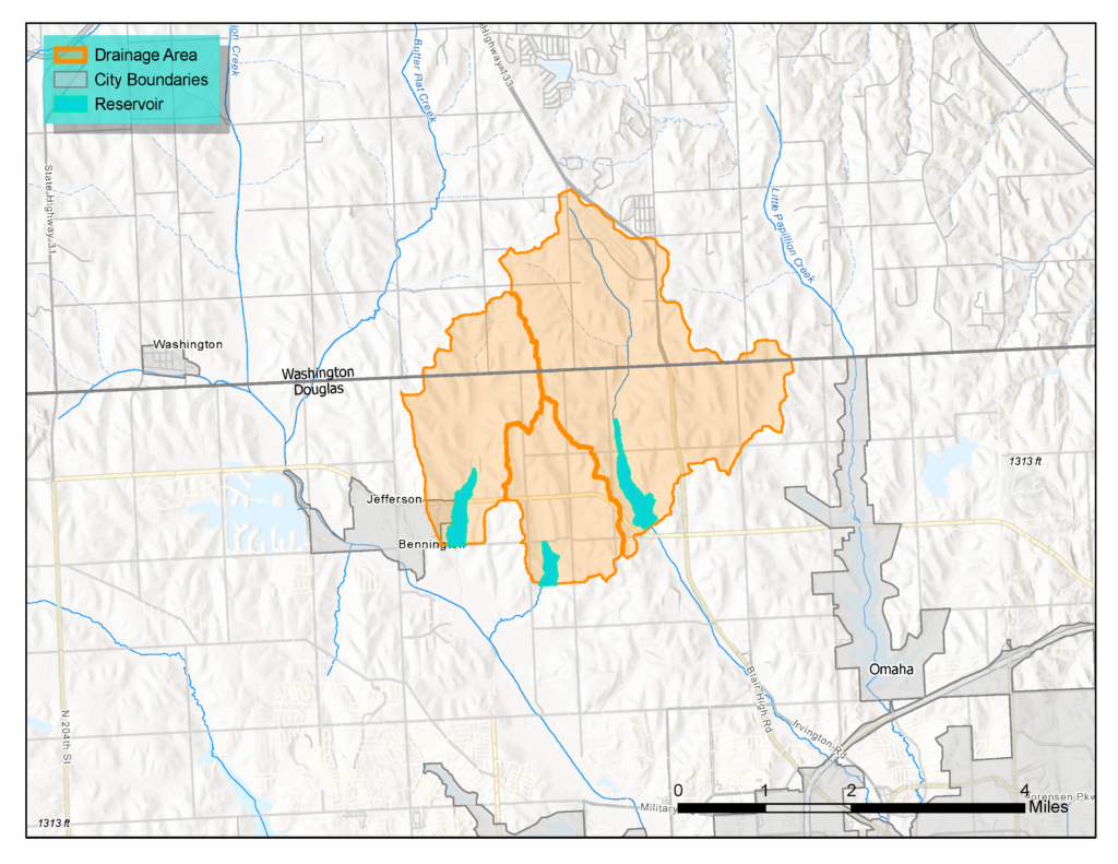
Dam Sites 8A, 9A, and 10 are all located north of Omaha and east of Bennington. These will be the final three regional detention structures designated for flood control within the Papillion Creek watershed as part of the PCWP plan. These are anticipated to be included in the implementation plan beginning in 2029. Combined, they will control more than 6,000 acres of drainage area.